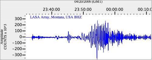
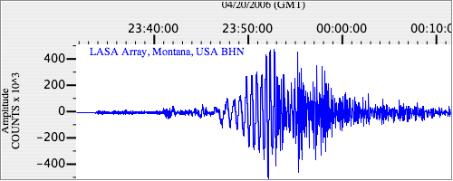
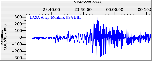
Seismograms for this Event
Event Info
| Region | Eastern Siberia, Russia |
| Time | 2006-04-20 19:25:04 -0400 |
| Magnitude | 7.7 M, |
| Depth | 38.5 km |
| Latitude | 61.07 |
| Longitude | 167.06 |
| Distance | 49.233 deg |
| Azimuth | 65.154 deg |
| Back Azimuth | 320.138 deg |
Station Info
| Id | LAO |
| Name | LASA Array, Montana, USA |
| Latitude | 46.6885 |
| Longitude | -106.2231 |
| Begin Time | 2004-07-14 20:00:00 -0400 |
| End Time | 2999-12-31 18:59:59 -0500 |
Seismograms
| US.LAO. .BHZ 50.459408 AD 2006.04.20 23:29:35.167 GMT |

|
| US.LAO. .BHN 5.245097 AD 2006.04.20 23:29:39.467 GMT |

|
| US.LAO. .BHE 9.891106 AD 2006.04.20 23:29:41.367 GMT |

|