
Warning: This page is no longer maintained and is preserved for historical purposes.
The Charleston Earthquake of 1886
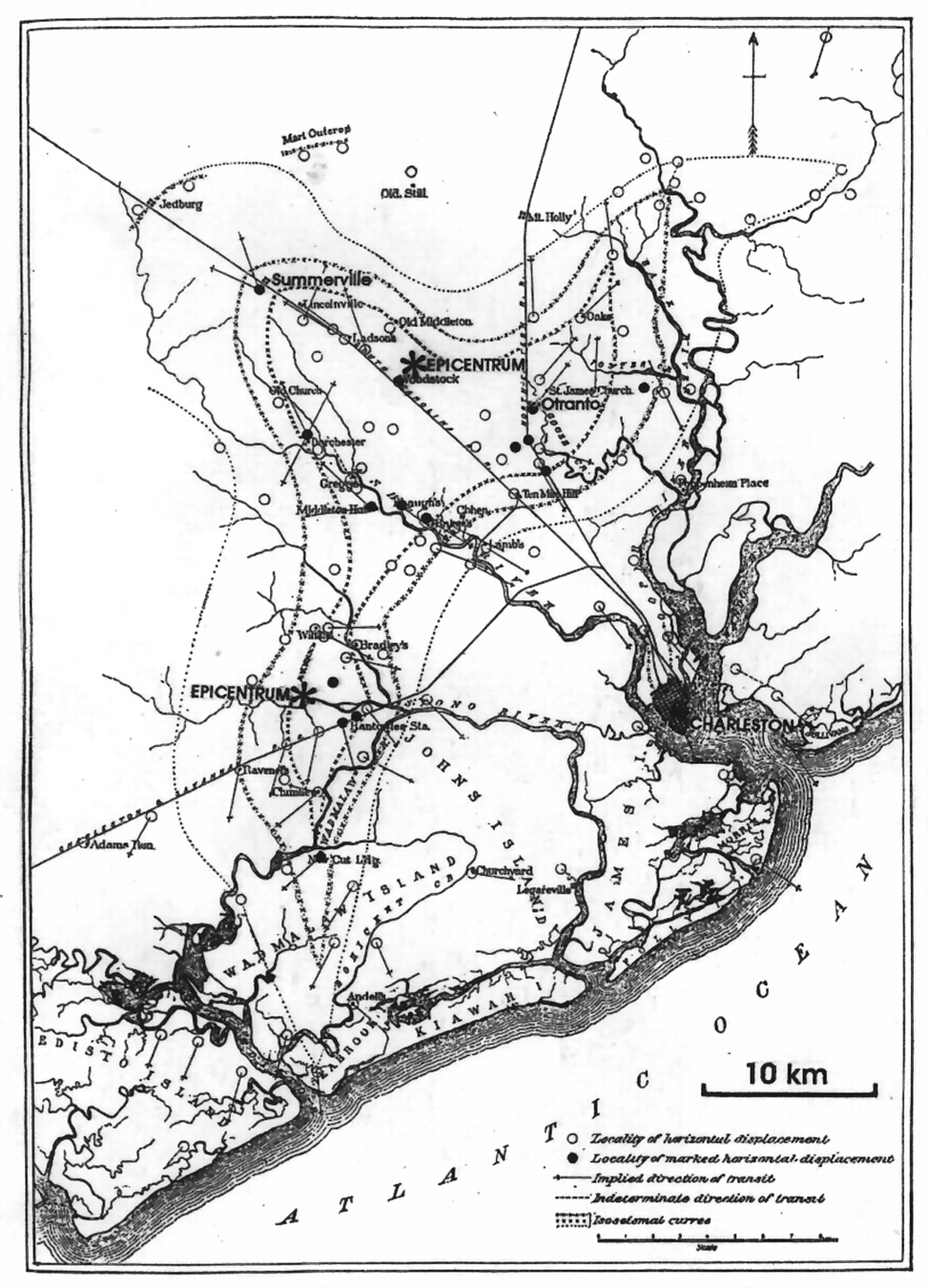
The seismic history of the southeastern United States is dominated by the 1886 earthquake that occurred in the Coastal Plain near Charleston, South Carolina. It was one of the largest historic earthquakes in eastern North America, and by far the largest earthquake in the southeastern United States. A major shock, occurred August 31, 1886 at approximately 9:50 p.m. and lasted less than one minute, but resulted in about sixty deaths and extensive damage to the city of Charleston. Because the event took place before seismological instrumentation, estimates of its location and size must come from observations of the damage and effects caused by the earthquake. Most of what we know of the even and the resulting damage comes from a comprehensive report by C.E. Dutton of the U.S. Geological Survey published in 1889. The meizoseismal area (area of maximum damage) of the 1886 earthquake is an elliptical area roughly 20 by 30 miles trending northeast between Charleston and Jedburg and including Summerville and roughly centered at Middleton Place.
The 1886 earthquake was followed by a series of aftershocks. Of 435 or more earthquakes reported to have taken place in South Carolina between 1754 and 1975, more than 300 were aftershocks that occurred in the first 35 years following 1886. The 1886 earthquake and its aftershocks dominate the seismic record of the southeast.
The historic record suggest the Charleston-Summerville area had a continuum of low level seimicity prior to 1886, and a low-level activity continues in the same area today.